How to Turn Landscape into Architecture on a Flood-Prone Site
On Proletarsky Island in Astrakhan, we proposed a masterplan that does not place buildings on the landscape but sculpts the terrain itself into architecture. The project works with flooding, seasonality, and ecology rather than against them.
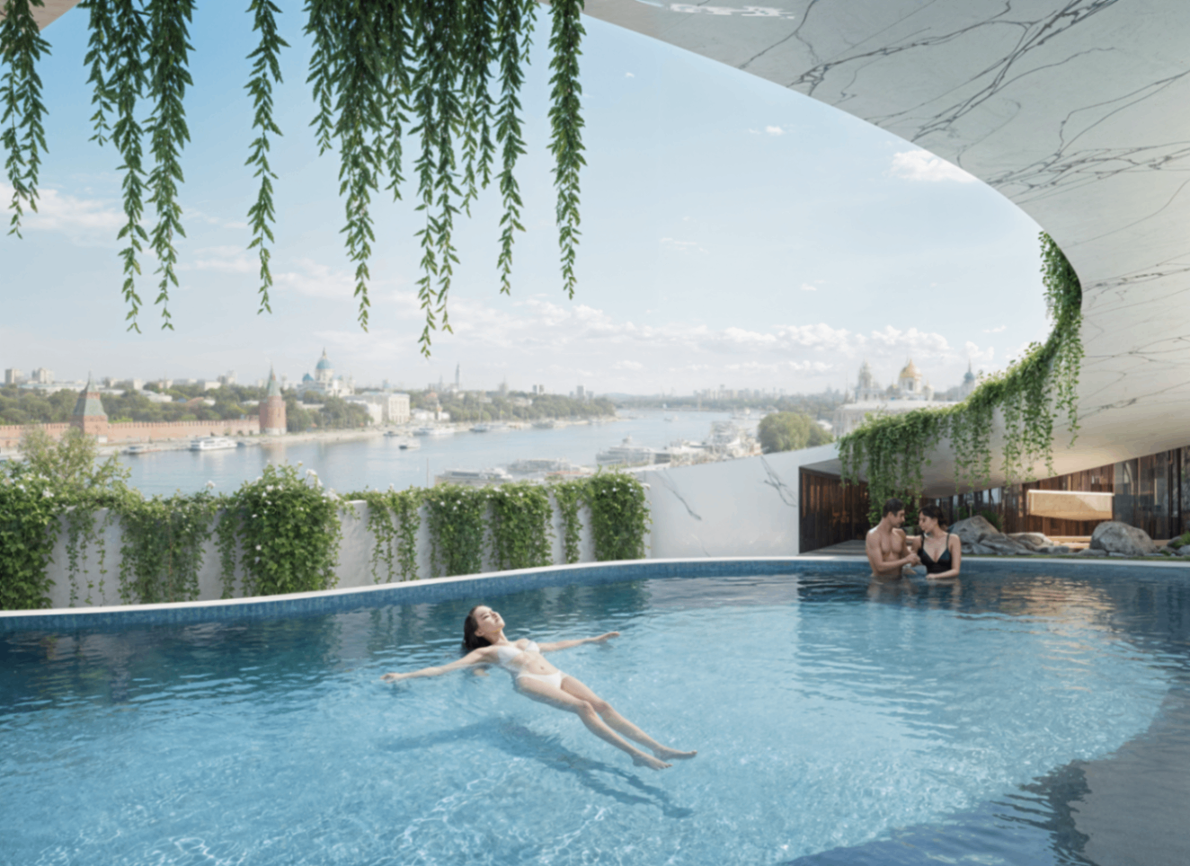
Most waterfront developments begin with a defensive instinct. The land is treated as unstable, the water as a threat, and architecture as something that must be placed above, against, or apart from the landscape.
The result is usually familiar: objects on a site, separated from the terrain, protected by technical measures, and only loosely connected to local ecology.
We wanted to begin elsewhere.
In our proposal for Proletarsky Island in Astrakhan, the question was not how to impose buildings onto a difficult landscape, but how to let the landscape itself become the basis of architecture. The island is a highly specific place: close to the city center, rich in natural features, and subject to strong seasonal change. In spring, much of it goes under water. In summer, it becomes a large recreational oasis used for swimming, fishing, picnics, and informal escape from the city. That dual condition made it clear that a conventional resort model would be too blunt. The island needed a spatial strategy that could work with flooding, seasonality, ecology, and public life at the same time.
The project, which we called Astrakhan Hills, proposes exactly that. Instead of treating the island as flat land waiting for buildings, we treated it as a topographic field that could be sculpted, thickened, and inhabited. Existing relief is amplified. Program is carved into it. Ecological surfaces remain above. Paths, water routes, and public spaces are woven through it. In this way, architecture does not sit on the landscape. It is made from a transformation of the landscape itself.
A flood-prone site should not be designed as if it were static
One of the main mistakes in waterfront development is to design for a fixed image of the site. But islands, deltas, riverbanks, and wetlands are not stable backgrounds. They are living systems. Water rises and falls. Wind changes comfort conditions. Different seasons produce different uses. If design ignores this, it produces fragile solutions.
In Astrakhan, this is not an abstract issue. The island changes through the year with the waters of the Volga. Parts of the territory can go under water temporarily without damage, and in winter many water-based activities transform into ice-based ones. The island is therefore not conceived as a summer-only destination, but as a place whose life shifts with the seasons. That logic is essential. It turns instability from a problem into a design driver.
This also changes what resilience means. Resilience is not only technical protection. It is the ability of a place to remain meaningful and usable under changing conditions.
Sculpting the ground instead of covering it
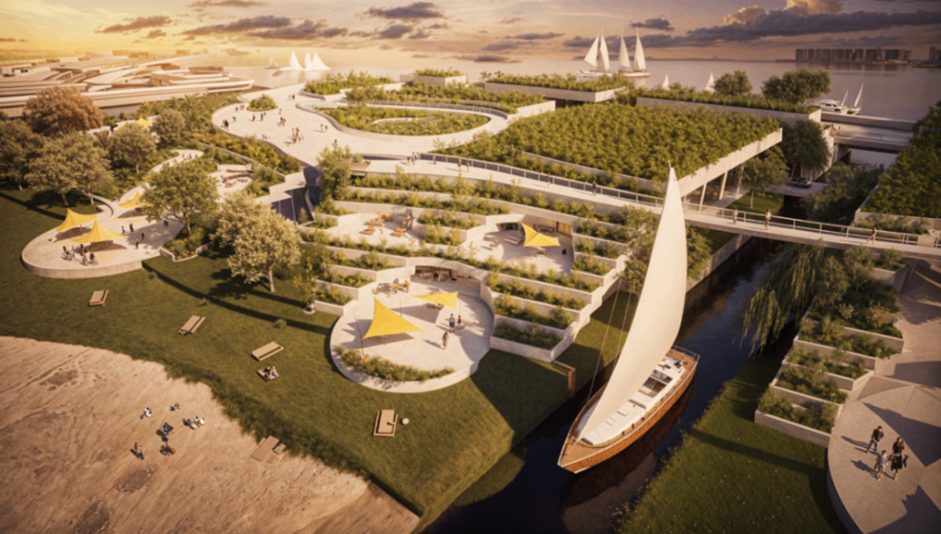
The central design move in this project is simple to describe but powerful in consequence: we scale and sculpt the existing terrain so that it can hold both landscape and program.
The proposal begins with the island's relief. That relief is expanded to meet the required area and program while staying within height limits. A grid is then developed to carve canyons and streets into the land, bringing light, access, and views into the deeper parts of the project. The remaining hills become occupiable built masses that contain hotels, public functions, sport, education, and other interior spaces. Finally, the spatial grid is extended toward the water, expanding usable public space and strengthening the relationship between land and river.
This approach matters because it avoids a false choice. We do not have to choose between "preserving nature" and "building on the site." Instead, the act of building becomes a controlled transformation of terrain. The island remains legible as landscape, but it gains thickness, shelter, interiority, and public program.
That is what we mean by turning landscape into architecture.
The roof becomes ecology
Once architecture is understood as sculpted ground, the roof is no longer a technical cap. It becomes part of the living surface of the island.
In this project, planted roofs and thick earth-covered envelopes protect interior spaces from summer heat and cold winter winds. At the same time, the upper surface remains part of the ecological system. The design preserves and extends habitats on top of the sculpted landform, allowing a wide range of species to inhabit different microconditions: shaded cuts for berries, sunny south-facing slopes for light-loving plants, and wet edges for species that thrive along the water. The project also aims to support migrating birds, bats, bees, and a wider biodiversity network.
This is a deeper ecological model than simply "adding green roofs." The green is not applied to buildings after the fact. The building is already conceived as part of the terrain and therefore as part of the island's ecological performance.
Climate is shaped through section, not only technology
Another strength of this strategy is climatic intelligence. On harsh open sites, comfort is often discussed only in terms of mechanical systems. But form matters just as much.
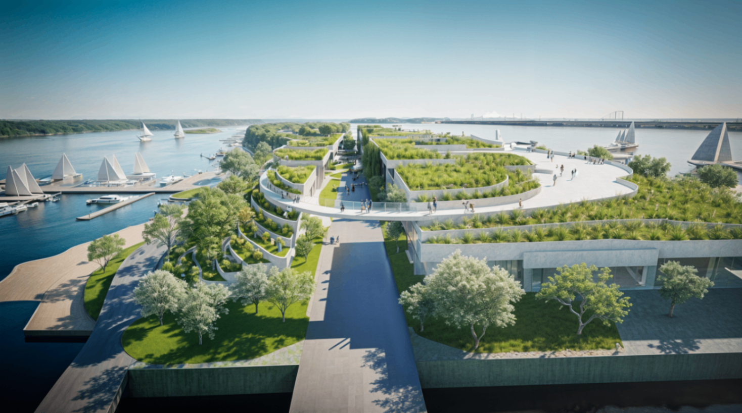
The project uses the position, rotation, and width of the carved grid, together with roof overhangs and landform, to create microclimatic conditions between the streets cut into the island. These spaces are shaped differently across the year — the cuts are designed both to protect from strong eastern winds and to admit summer breezes. Thick earth walls and planted roofs increase thermal protection, while shaded paths and natural ventilation improve comfort in hot periods.
This is important because it shows that environmental performance is not something added later by engineering. It is built into the spatial section of the project. The architecture works because the ground has been shaped intelligently.
A mixed-use island needs more than tourism
A good island masterplan cannot rely on one seasonal function alone. It needs overlapping systems of value.
That is why the project is organized into four major clusters: urban economy, sport, agriculture, and recreation. Education, lectures, exhibitions, workshops, offices, and cultural spaces form one layer. Sports infrastructure provides year-round use. Agricultural research and local food production create another productive layer tied to Astrakhan's biomes and food economy. Hotels, beaches, restaurants, promenades, and entertainment complete the recreational layer.
This is a crucial point. A flood-prone site should not only be resilient physically. It should be resilient programmatically. The more varied its rhythms of use, the more robust its economy and identity become.
Mobility should connect the island to the city, not isolate it
Another common problem with leisure islands is that they become enclaves. They function as destinations, but not as parts of the city.
This project tries to reverse that. The internal mobility network includes combined bus and car routes, underground parking, bicycle movement, and extensive pedestrian paths. More importantly, the island becomes more porous to water transport through the reshaping of its edge and the inclusion of cruise docks, river taxi stops, and a river terminal — part of a broader strategy to connect the island to museums, theatres, institutes, roads, and beaches across Astrakhan.
This matters because landscape-based development should not mean isolation. It should mean a richer interface between urban life and natural systems.
The section is the real masterplan
What this project ultimately demonstrates is that on a site like this, the section is more important than the object.
The key design questions are not only: Where does the hotel go? Where is the sport center? Where is the promenade? The deeper questions are sectional: What rises above flood level? What can tolerate seasonal water? Where does shade emerge? Where does wind pass? Where do ecological surfaces remain continuous? Where can interior space be inserted without destroying the landscape logic?
When these questions are answered well, a new kind of masterplan becomes possible. The project no longer looks like a collection of separate buildings. It reads as a living landform with embedded functions, public routes, habitats, and seasonal variation.
Toward a new model for waterfront development
Too much waterfront architecture still treats land as a platform and nature as scenery. But in places defined by water, sediment, wind, and seasonal transformation, that approach is too crude.
A better model begins by asking what the site already is, how it behaves over time, and how architecture might grow from those conditions rather than suppress them. In Astrakhan, that meant reading the island as topography, climate, habitat, and public territory all at once. It meant using carving instead of covering, gradients instead of zoning alone, and seasonal adaptation instead of rigid permanence.
The result is a project in which architecture and landscape are no longer opposites.
The landscape becomes the architecture.
If you are developing a waterfront site, island territory, or flood-prone area and want an approach that works with the landscape rather than against it, we can help shape a masterplan rooted in terrain, ecology, and public life.