What is included in a resort island masterplan concept
What a resort island masterplan concept actually contains: site reading, spatial diagram, zoning, circulation, microclimate, ecosystem, areas, renders. The Astrakhan Hills package.
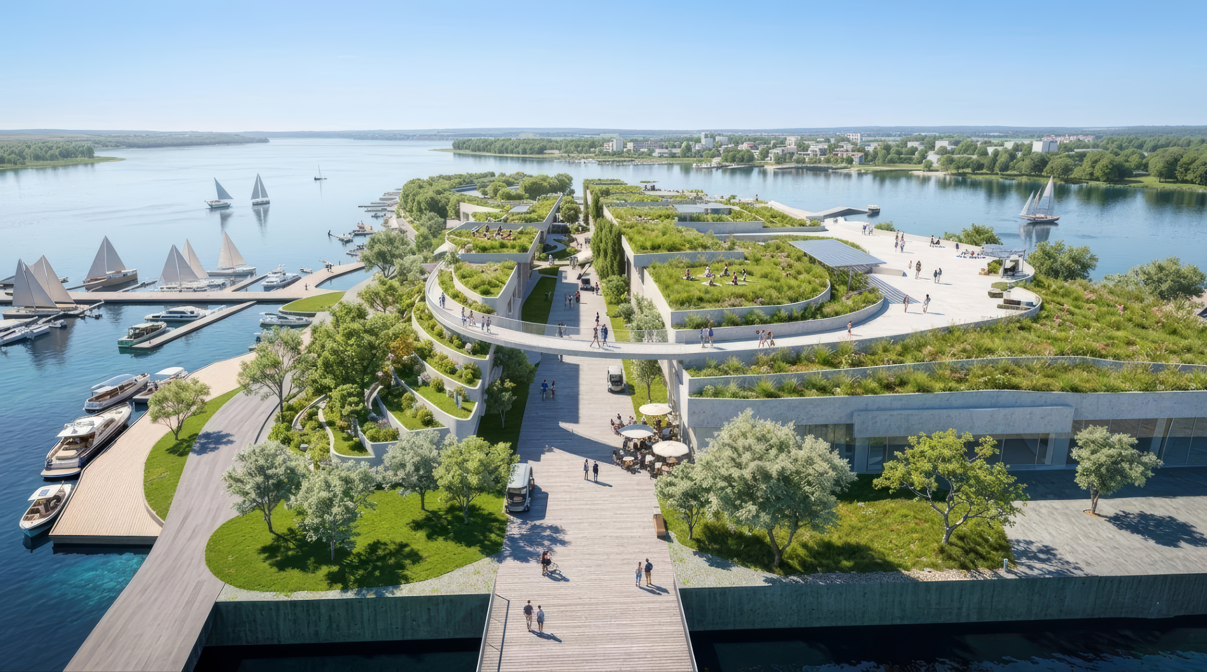
A resort island masterplan concept, as Lex te Loo Architects produces it, contains a delta and seasonal reading of the site, a four-step spatial diagram, a function zoning plan with an area schedule per use, circulation diagrams for road, water and pedestrian, microclimate studies built around solstice diagrams for 21 June, 21 September and 21 December, an ecosystem cross-section, a planting strategy keyed to soil conditions, and a sequence of renders. In our Astrakhan Hills project for Proletarsky Island on the Volga, this package was compiled into an eighteen-page jury brochure for a thirty-hectare island twenty minutes from the historic Astrakhan Kremlin.
What a concept must prove before form is fixed
A concept must prove that the client knows what they will actually build before any budget is spent on the next stages. That means program, area, circulation, climate, ecosystem and economics all have to converge in a single document, and they all have to follow from one spatial idea rather than sit as a set of independent decisions. In Astrakhan Hills, the concept was assembled as an eighteen-page brochure for the jury of an open architectural competition, and every part of it existed to answer one specific question about the future of the island.
A concept is not a presentation. It is the document on which an investment decision can be made.
Reading the site: climate, seasonality, economy, culture
The first thing a concept contains is an explicit reading of the site as a system of forces. For Astrakhan Hills this meant: the delta topography of the lower Volga with its lakes, dunes, Baer hillocks and channels; the industrial economy of Astrakhan, built on natural gas, sulphur, oil products, shipbuilding and fishing; a geographic position that gives the city an under-realised tourism potential; and the island opposite the historic Kremlin as the unrevealed pearl of that condition.
To the reading of place, the concept adds a reading of the seasonal regime. In spring, when the Volga rises, Proletarsky Island is almost entirely submerged. In summer it returns as a thirty-hectare oasis. The eastern wind is a strong year-round force, particularly in winter. Groundwater sits at -25 metres and the soil is saline. Without that reading, every form decision after it becomes arbitrary.
A four-step spatial diagram as the core of the concept
A concept must show one clear move from which everything else grows. In Astrakhan Hills that move was the refusal of the conventional figure of buildings-on-a-site, and a switch to working with the relief of the island itself as the primary architectural material. It is fixed in the four-step axonometric diagram on page seven of the brochure.
Step one: scale the existing relief up to the volume needed for the full program. Step two: cut a grid of canyon-streets through the resulting mass to bring daylight, views, water access and a sheltered microclimate inside the depth of the island. Step three: leave the residual hills as inhabitable solid, into which all required functions are carved. Step four: extend the street grid out onto the water and weave it into a circulation network that splits flows and opens long views.
This diagram is the core of the concept. Everything else in the brochure is subordinate to it.
Function zoning and area schedule
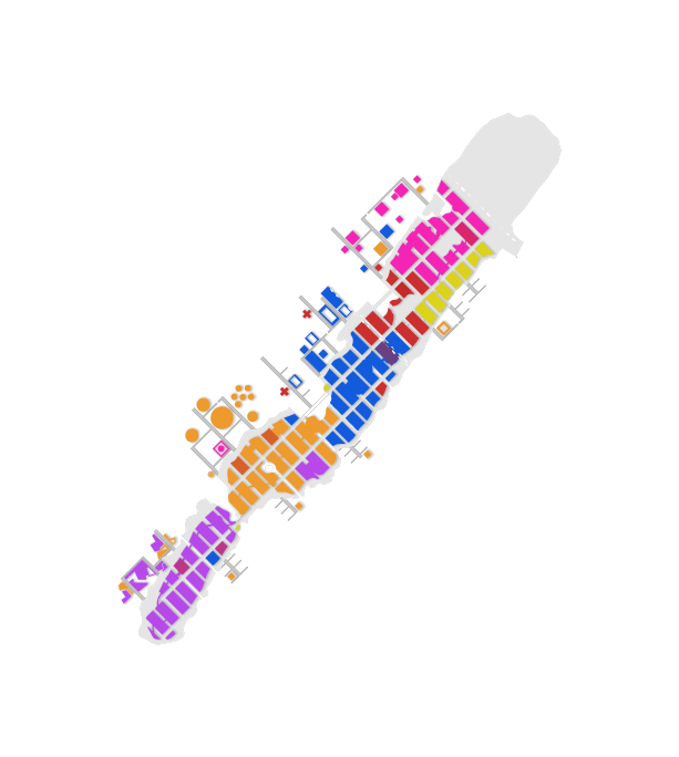
The concept must show which functions go where and how many square metres each one occupies. Without an area schedule, neither a jury nor an investor can verify whether the program is actually feasible on the site.
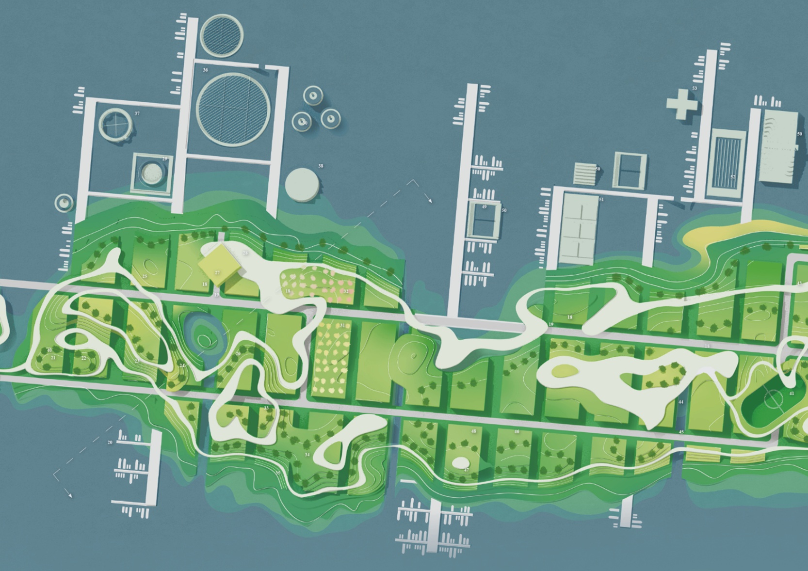
In Astrakhan Hills the program is split into four clusters: urban economy (lecture halls, exhibition spaces, workshops, offices, retail, co-working), sport (year-round facilities for training, education and competition), agriculture (research, education, preservation of Astrakhan biomes, production for local markets and restaurants on the island), and recreation (hotels, beaches, restaurants, promenades, entertainment). The schedule by function is roughly: education and culture 50,000 m², sport 33,868 m², hotels 36,500 m², recreation and parks 63,165 m². Total ground floor area is 226,700 m²; with roads, sidewalks and lawns it reaches 296,861 m². On the water the concept adds 23,400 m² of structures and 94,800 m² of pedestrian space.
Circulation: road, water, pedestrian
The concept of a resort island has to show three layers of circulation at the same time, because without them the island either collapses into a single road or cuts itself off from the city.
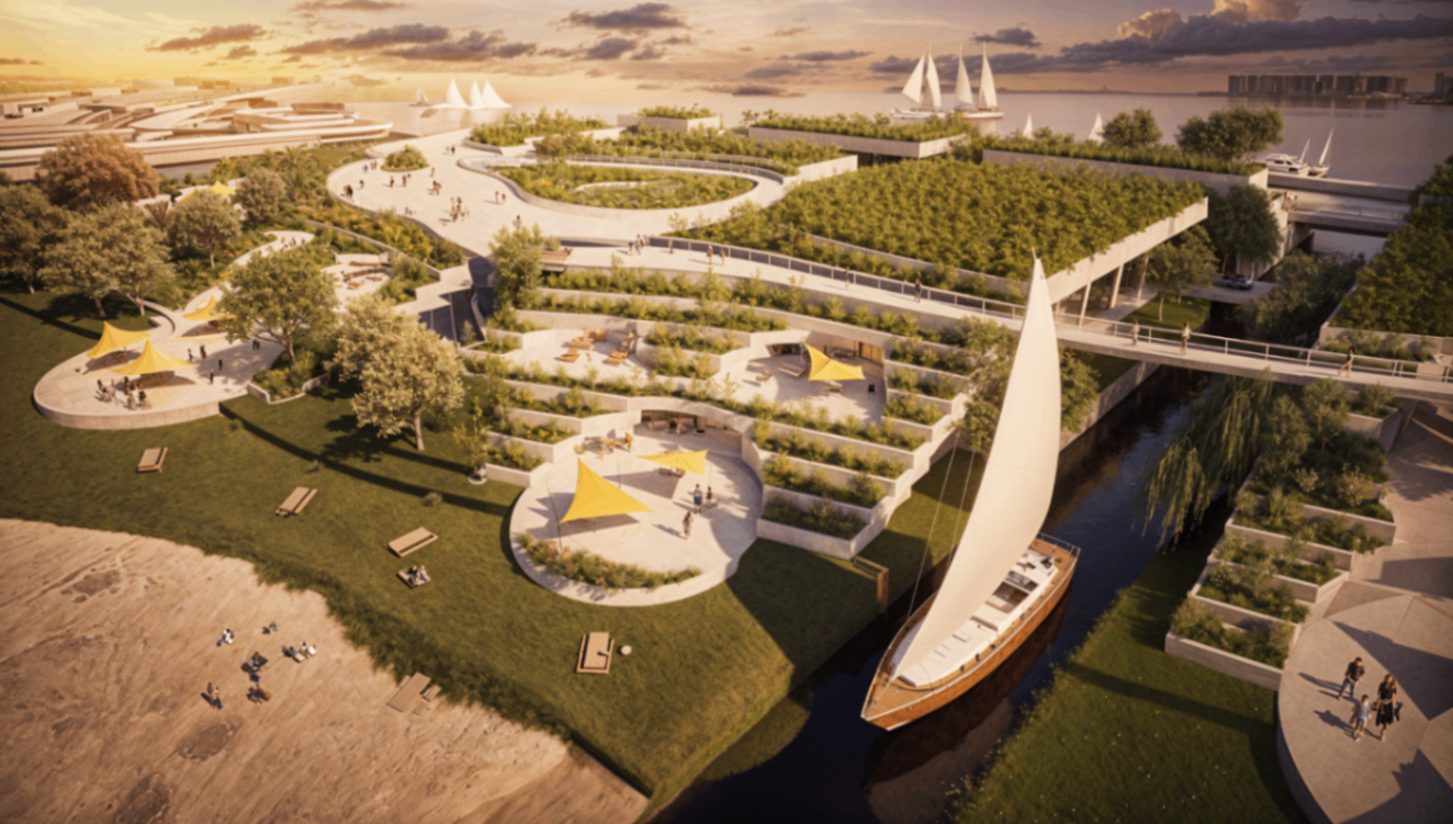
In Astrakhan Hills, underground parking sits below the carved relief. A combined bus and car road runs the length of the island, doubled by an embankment road so drivers also get the open river views. A bicycle network handles short internal trips. Most of the surface streets are pedestrian only, threaded between the hills as the canyon-cuts that also bring light and air into the mass. A pedestrian boulevard runs along the Volga bank, and walking paths climb the slopes to open wide river views.
The water network is part of the circulation system, not a backdrop. Astrakhan Hills adds private boat docks, a cruise ship pier, a city water taxi stop and a river station, and combines these with an extension of the city bus line. Together these moves pull the island back into the urban tissue of Astrakhan instead of leaving it as a separate destination.
Ecosystem, planting and microclimate
The concept includes an explicit reading of ecosystem, planting plan and microclimate — three separate but linked layers.
The cross-section through Astrakhan Hills moves through four ecosystems in sequence: an aquatic ecosystem, a wetland transition, north-facing shade slopes for shade-loving species, and south-facing sun slopes for sun-loving species. The planting plan is calibrated for Astrakhan's saline soil and includes cherry, oleaster, willow, poplar, several apple varieties, elm, alder, rosehip, lilac, white willow, tamarix, blackthorn, raspberry, currant, almond, elder, blueberry, wormwood and others, distributed across a sun-shade and wind-shelter gradient. Bioponds are built into the system to buffer the seasonal flood pulse and to filter and store water.
Microclimate is studied through solstice diagrams for 21 June, 21 September and 21 December. The orientation and width of the canyon grid are tuned to filter the strong eastern winter wind and to admit summer breezes from the river. Deep roof overhangs further shelter the streets.
What the client receives in the final package
The final concept package is the document on which a decision can be made and the next stage can begin. In Astrakhan Hills this package contained: a written project statement; a masterplan; the four-step axonometric method diagram; microclimate solstice diagrams for the three solstice dates; a function zoning plan with area schedule; a traffic and circulation diagram; a seasonal flood diagram; two ecosystem cross-sections; an urban context satellite map of greater Astrakhan; a planting distribution diagram; and a sequence of aerial, eye-level and physical-model renders. Eighteen pages, addressed to one audience and one decision.
Closing
A resort island masterplan concept is not a visual pitch or a catalogue of ideas. It is a package built around one spatial idea, in which site reading, diagram, program, areas, circulation, microclimate, ecosystem and renders all exist as one body. Astrakhan Hills shows what that package looks like: eighteen pages that turn a thirty-hectare flooded island on the Volga into a year-round project with four clusters and an amphibious architecture, instead of another row of hotel towers.
Lex te Loo Architects is an architecture bureau founded in 2018 and operating between the Netherlands and Russia. The bureau is led by Lex te Loo, who graduated Cum Laude from the master's programme at TU Delft, also studied at ETH Zurich and in the office of B. V. Doshi (Sangath, India), and worked as a researcher at The Why Factory under Winy Maas. The practice focuses on concept design, masterplanning and territorial concepts for projects up to 250,000 m², where form, program and direction are still open and architecture can define the entire project. The bureau's method is Metropolitan Intelligence and Geological Presence: a precise reading of urban and territorial forces translated into architecture with clear logic and strong presence.